Collins Childrens World Map
Код товара: 100040587

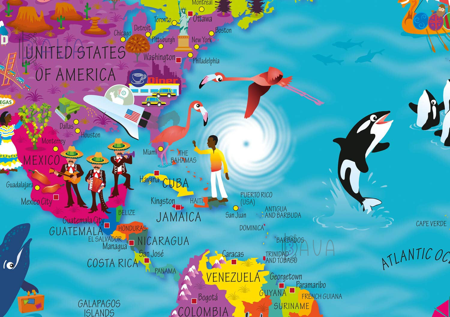

Colourful Illustrated Map of the World
This bestselling, highly illustrated pictorial map is designed to take children on a journey of discovery around the countries of the world. The mapping is up-to-day, colourful and highly informative and shows countries and capital cities.
Stunning illustrations are used to depict themes such as national emblems, customs, food, birds, animals, buildings and sports to help younger readers gain an understanding of peoples around the world.
Dimensions 610 X 915 mm / 24 x 36 inches
Illustrated by Steve Evans.
Пока нет комментариев
Похожие товары
![Путешествия. Атласы и карты: Lots of things to spot in London [Usborne]](https://bava.ua/files/products/9781474916196-things-spot-london.300x300.jpg "Lots of things to spot in London [Usborne]")
![Путешествия. Атласы и карты: Around the world mazes [Usborne]](https://bava.ua/files/products/s3kjeivi.300x300.jpg "Around the world mazes [Usborne]")
Наши скидки испециальные цены
Проверьте предложения по акции. Экономить приятно!
Смотреть все
![Путешествия. Атласы и карты: Pop-up London [Usborne]](https://bava.ua/files/products/9781474939584_cover_image.300x300.jpg "Pop-up London [Usborne]")

![Путешествия. Атласы и карты: Big Picture Atlas [Usborne]](https://bava.ua/files/products/9781409598701.300x300.jpg "Big Picture Atlas [Usborne]")
